Park County, Wyoming
Planning and Zoning Department
: Subdivisions
Contact Information:
- OFFICE LOCATION: 1002 Sheridan Ave., Suite 109, Cody, WY 82414
- Cody: (307) 527-8540
- Powell: (307) 754-8540
- Office Hours: 8:00am - 5:00pm
- Monday - Friday
- Appointments are strongly encouraged
- Click here to email us.
Staff Directory:
- Kim Hardage - Office Assistant
- Kelby Tranas - SWW Admin/Planning Tech
- Erika Decker - Planner II
- Kim Dillivan - Assistant Director
- Joy Hill - Director / Floodplain Administrator
Subdivisions
Sale of Land in Unapproved Subdivision:
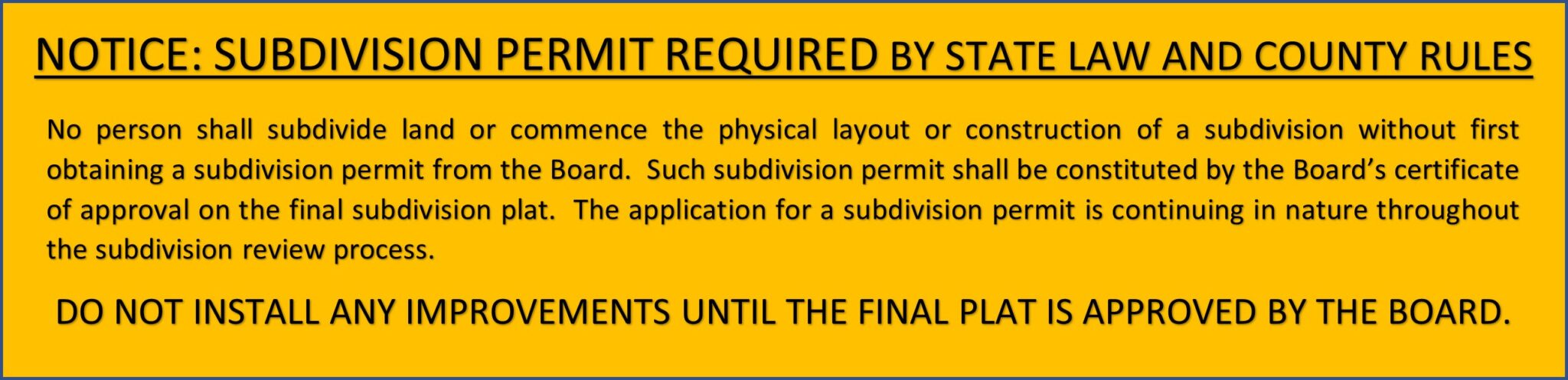
No owner or agent of an owner of any land shall transfer or sell any land by reference to, exhibition of, or use of a plan or plat of a subdivision before such plan or plat has been approved and recorded. The description of such lot or parcel by metes and bounds in the instrument of transfer or other documents used in the process of selling or transferring shall not exempt the transaction from these provisions. Notwithstanding the foregoing, in the case of condominium or townhouse type developments, an owner may enter into binding agreements to sell lots or units subsequent to approval of a Final Plat. Conveyance of individual lots or units, however, shall not occur until approval and recordation of Final Plat.
Types of Subdivisions:
Park County recognizes the following subdivision classifications:
- Exempt Divisions
- Simple Subdivision
- Minor Subdivision
- Major Subdivision
- Large Acreage Subdivisions
- Exempt Large Acreage Subdivision (35-40 acres)
- Non-Exempt Large Acreage Subdivision (35-40 acres)
- Large Acreage Subdivision (41-140 acres)
SIMPLE SUBDIVISION
A simple subdivision is the division of a tract of record into not more than two (2) lots, each lot being smaller than 35 acres. An existing subdivision lot may be divided using the simple subdivision process so long as the division creates no more than two (2) lots each smaller than 35 acres within the existing subdivision or tract of record. Simple subdivision lots do not need to be configured to create a contiguous developed area. A subdivision shall NOT be classified as a simple subdivision under the following circumstances:
- The subdivision will be served by a central sewage disposal system or central water supply system not owned and operated by a public entity; review will be as a major subdivision;
- The land to be subdivided is unsuitable for simple subdivision . Land unsuitable for simple subdivision is defined as land that if subdivided would be detrimental to the health, safety, or general welfare of existing or future residents because of potential hazards including flooding, landslides, steep slopes, rock falls, high water table, polluted or non-potable water supply high voltage lines, high pressure gas lines, danger from fire or explosion or other hazardous features. The presence of any of these features determined by the Commission to be detrimental to the health, safety or general welfare of existing or future residents if the land is subdivided does not preclude subdivision approval provided the subdivision is reviewed as a major subdivision and the hazards are eliminated or will be overcome by approved design and construction plans, where applicable.
Simple Subdivision Review Process
- Pre-application: Meet with the Planning Office for a pre-application meeting.
- Application: Submit a complete Simple Subdivision Application, including:
- Application & Fee
- Proof that a “Notice of Intent to Subdivide” has been published in a local newspaper in the legal notice section once each week for two (2) weeks within 30 days prior to filing the application . The notice shall include the name of the subdivider, general location of the land to be subdivided, number and size of lots proposed, and intended uses within the subdivision;
- Title report;
- Garbage disposal availability;
- Fire protection availability;
- Postal service and mail delivery points;
- School bus stop/pullout locations;
- Information on availability of service providers for cable TV, telephone, gas and electricity with addresses and phone numbers, indicating which of these services has been extended to the lots in the subdivision;
- Any known information concerning landslides, steep slopes, rock falls, high water tables, polluted or non-potable water supply, high voltage lines, high pressure gas lines, danger from fire or explosion or other hazardous features on the property;
- Evidence that a soils report has been requested from the Local Conservation District;
- Evidence the Irrigation District has been contacted;
- Evidence the Weed & Pest District has been contacted;
- Proof of ownership showing encumbrances of record;
- Legible and reproducible 11”x17” Sketch Plan that includes:
- Abbreviated legal description
- Boundaries of the parcel to be subdivided
- Lot layout with approximate dimensions and acreages
- Total acreage of subdivision
- Size and location of any open spaces
- Current County zoning classification
- Existing structures, wells, and septic facilities
- Irrigation facilities and direction of flow where flood irrigation is proposed
- Means of access from the lots to the public road system
- Existing uses of adjoining properties
- Sketch Plan Review with P&Z: The Planning Office will schedule the Sketch Plan review with the Planning & Zoning Commission once all required application materials have been received. Please see the Planning & Zoning main page for the Meeting calendar.
- Final Plat Application: The Planning Office will schedule the Final Plat review with the Board of County Commissioners upon receipt of a complete final plat application and fulfillment of applicable conditions from sketch plan approval. After the Board has approved the final plat and the Planning Office has obtained all necessary signatures, the applicant may submit the approved final plat with required fees for recordation to the Clerk & Recorder. The approved final plat must be accompanied by a signed / notarized disclosure statement (Appendix 6), weed abatement plan, irrigation plans, easements and rights-of-way, covenants and Homeowners Association documents, if applicable. These items shall be recorded concurrently with the final plat.
Municipal Review Requirement
The City shall review any plat of land within 1 mile of the boundaries of any incorporated city or town.
Meeteetse Planning Area Review Requirement
Meeteetse Planning Area: For applications within the Meeteetse Local Planning Area, the Meeteetse Local Planning Area Advisory Committee must review the proposal.
See Chapter III of the Development Standards and Regulations for complete subdivision process requirements.
MINOR SUBDIVISION
A minor subdivision is the division of a tract of record1 into not more than five (5) lots, each lot being smaller than 35 acres. An existing subdivision lot may be divided using the minor subdivision process so long as the division creates no more than five (5) lots each smaller than 35 acres within the existing subdivision or tract of record. Minor subdivision lots shall be configured to create a contiguous developed area. Minor subdivisions must comply with the Minor Subdivision Review Process. A subdivision shall NOT be classified as a minor subdivision under the following circumstances:
(1) The number of lots in the proposed minor subdivision in combination with existing lots on the underlying tract of record would result in more than five (5) lots each smaller than 35 acres. If more than five (5) such lots, the proposed subdivision must follow the major subdivision review process.
(2) The land to be subdivided is a lot in a platted subdivision and the number of lots created by the proposed division in combination with all other lots in the existing subdivision would exceed five (5) lots. If more than five (5) lots, the proposed subdivision must follow the major subdivision review process.
(3) The subdivision will be served by a central sewage disposal system or central water supply system not owned and operated by a public entity;
(4) The land to be subdivided is unsuitable for minor subdivision. Land unsuitable for minor subdivision is defined as land that if subdivided would be detrimental to the health, safety, or general welfare of existing or future residents because of potential hazards including flooding, landslides, steep slopes, rock falls, high water table, polluted or non-potable water supply, high voltage lines, high pressure gas lines, danger from fire or explosion or other hazardous features or potential therefore as a result of the proposed subdivision as determined by the Planning Director. The presence of any of these features determined by the Commission to be detrimental to the health, safety or general welfare of existing or future residents if the land is subdivided does not preclude subdivision approval provided the subdivision is reviewed as a major subdivision and the hazards are eliminated or will be overcome by approved design and construction plans, where applicable.
Minor Subdivision Review Process (Abbreviated)
- Pre-application: Meet with the Planning Office for a pre-application meeting.
- Application: Submit a complete Minor Subdivision Application, including:
- Application & Fee
- Proof that a “Notice of Intent to Subdivide” has been published in a local newspaper in the legal notice section once each week for two (2) weeks within 30 days prior to filing the application . The notice shall include the name of the subdivider, general location of the land to be subdivided, number and size of lots proposed, and intended uses within the subdivision;
- Title report;
- Garbage disposal availability;
- Fire protection availability;
- Postal service and mail delivery points;
- School bus stop/pullout locations;
- Information on availability of service providers for cable TV, telephone, gas and electricity with addresses and phone numbers, indicating which of these services has been extended to the lots in the subdivision;
- Any known information concerning landslides, steep slopes, rock falls, high water tables, polluted or non-potable water supply, high voltage lines, high pressure gas lines, danger from fire or explosion or other hazardous features on the property;
- Evidence that a soils report has been requested from the Local Conservation District;
- Evidence the Irrigation District has been contacted;
- Evidence the Weed & Pest District has been contacted;
- Proof of ownership showing encumbrances of record;
- Legible and reproducible 11”x17” Sketch Plan that includes:
- Abbreviated legal description
- Boundaries of the parcel to be subdivided
- Lot layout with approximate dimensions and acreages
- Total acreage of subdivision
- Size and location of any open spaces
- Current County zoning classification
- Existing structures, wells, and septic facilities
- Irrigation facilities and direction of flow where flood irrigation is proposed
- Means of access from the lots to the public road system
- Existing uses of adjoining properties
- Sketch Plan Review Hearing with P&Z: The Planning and Zoning Department will schedule the a Sketch Plan review hearing with the Planning & Zoning Commission once all required application materials have been received. Please see the Planning & Zoning main page for the Meeting calendar.
- Sketch Plan Review Hearing with BCC: Following the recommendation of the Planning and Zoning Commission on the Sketch Plan, the Planning and Zoning Department will schedule a Sketch Plan review hearing with the Board of County Commissioners.
- Final Plat Application: Upon completion of all required conditions, the Board of County Commissioners shall review a complete final plat application. A fee is required upon application submission to the Planning and Zoning Department. No public hearing is required.
Municipal Review Requirement
The City shall review any plat of land within 1 mile of the boundaries of any incorporated city or town.
Meeteetse Planning Area Review Requirement
Meeteetse Planning Area: For applications within the Meeteetse Local Planning Area, the Meeteetse Local Planning Area Advisory Committee must review the proposal.
See Chapter III of the Development Standards and Regulations for complete subdivision process requirements.
MAJOR SUBDIVISION
A major subdivision is the division of a tract of record into six (6) or more lots, each smaller than 35 acres. Major subdivisions lots shall be configured to create a contiguous area. A major subdivision also includes any subdivision that does not qualify as a simple or minor subdivision. Major subdivisions must comply with the Major Subdivision Review Process.
Major Subdivision Review Process (Abbreviated)
- Pre-application: Meet with the Planning Office for a pre-application meeting.
- Application: Submit a complete Major Subdivision Application, including:
- Application & Fee
- Proof that a “Notice of Intent to Subdivide” has been published in a local newspaper in the legal notice section once each week for two (2) weeks within 30 days prior to filing the application . The notice shall include the name of the subdivider, general location of the land to be subdivided, number and size of lots proposed, and intended uses within the subdivision;
- Title report;
- Garbage disposal availability;
- Fire protection availability;
- Postal service and mail delivery points;
- School bus stop/pullout locations;
- Information on availability of service providers for cable TV, telephone, gas and electricity with addresses and phone numbers, indicating which of these services has been extended to the lots in the subdivision;
- Any known information concerning landslides, steep slopes, rock falls, high water tables, polluted or non-potable water supply, high voltage lines, high pressure gas lines, danger from fire or explosion or other hazardous features on the property;
- Evidence that a soils report has been requested from the Local Conservation District;
- Evidence the Irrigation District has been contacted;
- Evidence the Weed & Pest District has been contacted;
- Proof of ownership showing encumbrances of record;
- Legible and reproducible 11”x17” Sketch Plan that includes:
- Abbreviated legal description
- Boundaries of the parcel to be subdivided
- Lot layout with approximate dimensions and acreages
- Total acreage of subdivision
- Size and location of any open spaces
- Current County zoning classification
- Existing structures, wells, and septic facilities
- Irrigation facilities and direction of flow where flood irrigation is proposed
- Means of access from the lots to the public road system
- Existing uses of adjoining properties
- Sketch Plan Review with P&Z: The Planning and Zoning Department will schedule the Sketch Plan review with the Planning & Zoning Commission once all required application materials have been received. Please see the Planning & Zoning main page for the Meeting calendar.
- Preliminary Plat Review with P&Z: Following approval of the Sketch Plan, the Planning and Zoning Department will schedule Preliminary Plat review hearing with the Planning and Zoning Commission upon receipt of the following materials and information:
- Application & Fee: The applicant shall submit a Preliminary Plat Application, plus seven (7) full size prints of the preliminary plat and one reproducible 11″ x 17″ copy (unless otherwise directed by staff). All Preliminary Plats shall include the information as required in Appendix 2 – Preliminary Plat Specifications.
- Department of Environmental Quality: Provide the letter of recommendations from the DEQ resulting from the submittal of a study evaluating the sewage system and water supply system proposed for the subdivision as required by Wyoming Statute §18-5-306(a)(iv) through (vi). Provide a complete copy of the application that was submitted to the DEQ that resulted in the letter of recommendations.
- Access: Documentation that adequate access has been provided and that all proposed streets, alleys and roadways within the subdivision conform to the minimum standards adopted by the Board. If, however, the subdivider proposes to make any streets, alleys or roadways private, then the subdivider shall submit to the Board properly acknowledged written certification that certain streets, alleys or roadways within the subdivision shall remain private and the Board shall be under no obligation to repair, maintain or accept any dedication of such roads to the public use.
- Proposed Covenants/Homeowners Association Agreement: A copy of any Homeowner’s Association agreement and covenants proposed for the subdivision;
- Mail/Utilities: A letter from the utility companies stating capacity exists to serve the proposed development and a letter from the U.S. Postal Service stating circumstances relevant to mail service;
- Miscellaneous: Other information requested by the Commission during the sketch plan review;
- Fees: Evidence showing payment of all applicable fees.
- Preliminary Plat Review with BCC: Following recommendation of the Planning and Zoning Commission, the Planning and Zoning Department shall schedule a Preliminary Plat review hearing with the Board of County Commissioners. Approval of a preliminary plat is effective for one year from the date of approval.
- Final Plat Application: Upon completion of all required conditions, the Board of County Commissioners shall review a complete final plat application. No public hearing is required.
- Municipal Review Requirement
The City shall review any plat of land within 1 mile of the boundaries of any incorporated city or town. - Meeteetse Planning Area Review Requirement
Meeteetse Planning Area: For applications within the Meeteetse Local Planning Area, the Meeteetse Local Planning Area Advisory Committee must review the proposal.
See Chapter III of the Development Standards and Regulations for complete subdivision process requirements.
NON-EXEMPT LARGE ACREAGE SUBDIVISION
A subdivision permit will be required where 11 (eleven) or more parcels are created of 35 acres up to 40 acres (see Chapter III, Section 7b). The following requirements shall apply:
(1) A survey plat containing the following:
A. Date of preparation, scale and north arrow;
B. The location of the subdivision including the section, township and range;
C. The location and dimension of existing and proposed lots, units, tracts, parcels, streets, alleys , roads , highways, public ways, utility rights-of-way, easements , parks and the location of proposed permanent buildings and structures if known.
(2) Where individual on-lot sewage systems are proposed, the words “NO PROPOSED CENTRALIZED SEWAGE SYSTEM” in bold capital letters shall appear on all offers, contracts, agreements and plats relating to the subdivision . For centralized waste disposal systems, documentation is required evaluating the adequacy and safety of the system;
(3) If the subdivider proposes to utilize adjoining property for sewers, drainage , sewer lines, power lines or other utilities , the subdivider shall provide copies of binding easements of not less than twenty (20) feet in width for the proposed facilities from each property owner over whose land such services shall extend and shall provide a minimum access roadway right-of-way of sixty (60) feet to the subdivision for all public ways. Where no or limited on-lot utility connections are proposed, the words “NO PROPOSED UTILITY CONNECTIONS” or “LIMITED UTILITY CONNECTIONS” as appropriate, in bold capital letters shall appear on all offers, contracts, agreements and plats relating to the subdivision . A permit shall not be denied for failure to provide on-lot utility connections;
(4) Where individual on-lot wells are proposed, the words “NO PROPOSED CENTRAL WATER SUPPLY SYSTEM” in bold capital letters shall appear on all offers, contracts, agreements and plats relating to the subdivision . For central water supply systems, documentation is required to evaluate the adequacy and safety of the system. The study shall include information relative to the potential availability and quality of groundwater proposed within the subdivision which may consist of new data, existing data on other working wells in the area, or other data, including drilling logs, from a test well drilled within the proposed subdivision indicating soil types, depth, quantity and quality of water produced in the test well.
(5) Documentation that adequate ingress and egress access has been provided to all proposed lots, units, tracts and parcels and that all proposed lots, units, tracts, parcels, streets, alleys and roadways within the subdivision conform to the minimum standards adopted by the Board. If the subdivider proposes to make any streets, alleys or roadways private, a properly acknowledged written certification that declares certain streets, alleys or roadways within the subdivision shall remain private, and the board shall be under no obligation to repair, maintain or accept any dedication of these roads to the public use. If no such public maintenance is contemplated on any of the roads, the subdivider shall put a legend on the plat of the subdivision and on all offers, contracts or agreements for the sale and purchase of lots within the subdivision showing the streets, alleys and roadways showing in capital letters “NO PUBLIC MAINTENANCE OF SPECIFIED STREETS OR ROADS” ;
(6) Documentation there are adequate financial resources to develop and complete any facility that is the responsibility of the developer, including but not limited to water supply systems, sewage systems, streets and roadways. The applicant shall provide a performance bond, acceptable letter of credit or other sufficient financial commitment to assure that any facilities proposed or represented to be part of the subdivision will in fact be completed as proposed, or escrow sufficient monies out of land sales to guarantee that the above facilities are installed. The amount of any bond or other financial commitment or escrow required under this paragraph shall reflect the estimated costs of providing the facilities;
(7) Obtain review and recommendations from the local conservation district regarding soil suitability, erosion control, sedimentation and flooding problems. The review and recommendations shall be completed within sixty (60) days.
(8) Obtain review and recommendations from a fire protection district in which any portion of the subdivision lies, or from the nearest fire protection district if no part of the subdivision lies within a fire protection district, regarding adequacy of fire protection measures. If the entire subdivision does not lie within a fire protection district and no city, town or fire protection district is obligated to provide fire protection pursuant to an agreement authorized by law, the subdivider shall put a legend on the plat of the subdivision and on all offers, contracts or agreements for the sale and purchase of lots within the subdivision showing in capital letters “LOTS ARE NOT PART OF A FIRE PROTECTION DISTRICT AND FIRE PROTECTION IS NOT OTHERWISE PROVIDED”.
(9) A legend shall be placed on the plat and on all offers, contracts or agreements for the sale and purchase of lots within the subdivision showing in capital letters “THE SURFACE ESTATE OF THE LAND TO BE SUBDIVIDED IS SUBJECT TO FULL AND EFFECTIVE DEVELOPMENT OF THE MINERAL ESTATE” .
(10) With respect to any water rights appurtenant to lands to be subdivided in accordance with this section and prior to final approval of the subdivision the developer shall provide for state requirements for disposition of water rights (Ch.III Sec.3 e).
(11) Evidence the parcels comply with zoning requirements, including roads that access more than 4 (four) parcels are built to county standards.
(12) Public hearing (s) with the Planning & Zoning Commission and Board of County Commissioners.
Park County Planning and Zoning Department | 1002 Sheridan Ave. Suite 109, Cody, WY 82414 | 307-527-8540 | planning@parkcounty-wy.gov